Observing the World’s Ocean from Space

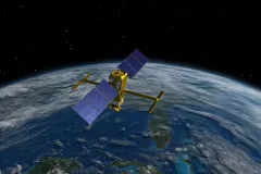
Above the world, about 550 miles up in space, a satellite orbits the globe and dutifully monitors the ocean. The scientific heart of the satellite is an instrument called a radar interferometer, which uses microwave signals to measure the height of water in Earth’s ocean and freshwater bodies. This is the mission of the Surface Water and Ocean Topography (SWOT) satellite, a brand-new satellite launched in December 2022. Researchers can use information from SWOT on sea surface height to study multiple aspects of the ocean, including surface currents.
Ocean currents are responsible for distributing heat around the globe. They directly affect weather patterns and are essential to weather forecasts. And as global climate change continues, monitoring the ocean’s currents will indicate how the ocean is responding to increases in temperature. Information obtained by studying currents will help governments and ocean communities prepare for shifts related to climate change, like sea level rise and extreme weather. Additionally, ocean currents affect the distribution of phytoplankton and zooplankton (tiny marine plants and animals), the ability for sound to travel across vast ocean distances, and in the event of an oil spill, the spread of oil from the spill site.
Prior to the 1970s, ocean currents were difficult to measure. Early mariners mapped the ocean currents from aboard ships, noting in their logs as they traversed the globe. By the mid 1700s the invention of the chronometer, an instrument that measured a ship’s location using the angle of the sun, was critical to logging currents using latitude and longitude, but the method was limited to physically being at the location of measurement. Currents could also be measured by dropping buoys in the middle of the sea with a note for beach combers to contact scientists with their location when the buoys washed ashore. It was a crude method, but ultimately helped us understand the extent to which currents move floating objects across the globe. Today, drifter experiments are still extremely important, with a slight technological upgrade. Now buoys are equipped with GPS tags and dropped in the middle of the ocean. They are tracked not via a handwritten note, but via satellites. Scientists also use fixed moorings, ship-based measurements, and satellites to monitor currents.
Observing the ocean has always been a challenge; it is immensely large and ever-evolving. Ship-based measurements and drifting buoys are localized in space and time, and lack the ability to observe the ocean from a truly global perspective. Fortunately, ocean currents influence more than just water flow—they also influence ocean height. One important characteristic of surface currents is that they play a part in pushing water into valleys and gullies—sea level is not a uniform height as it appears to the naked eye but rather an undulating surface. Scientists can use these subtle height differences to map the world’s currents. What better place to do so than from space where the whole ocean is in view? This is where satellites come into play.
The SWOT satellite follows a line of past satellites that were designed to monitor the ocean. Starting in 1978, the Seasat was NASA’s first Earth-orbiting satellite designed to observe the world’s ocean. It could measure sea surface height to the nearest four inches (10 cm), the length of a deck of cards, and could capture changes in sea surface at a scale of about 100 miles (150 km), or an area the size of the Queens borough of New York City. It was an awe inspiring first glimpse at the ocean’s currents, but at such a low resolution many of the smaller eddies and currents were missed. Next came Geosat, a Navy mission which improved the height accuracy to two inches (5 cm) and the resolution to 30 miles (50 km). However, NASA’s long-term continuous monitoring of the ocean’s currents truly began in 1992 with the launch of the TOPAX/Poseidon, the JASON satellites and Sentinal-6 missions.
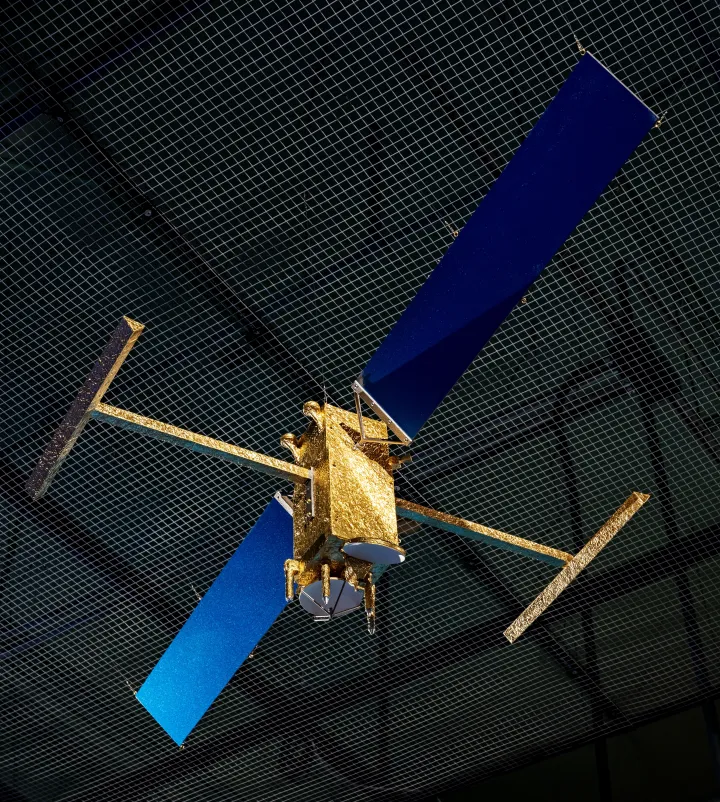
The launch of the SWOT satellite in December 2022 has enabled scientists to get an even more accurate picture of the world’s ocean. The two antennas on either side of the satellite are part of the new interferometer instrument technology used to measure sea surface height. The radar pulses bounce off the sea surface, and the satellite computes the height using differences between the signal received by the two antennas. The use of two antennas allows for the instrument to measure 30 miles (50 km) on either side of the satellite for at total band of 72 miles (120 km), or about the length of Connecticut. An additional instrument, the conventional altimeter used on previous satellites, covers the 12 miles gap between the two antennas.
“Previous satellite altimetry missions took one-dimensional measurements of the ocean, so it was hard to resolve the spatial characteristics of the ocean with any clarity,” says Matt Archer. “Even multiple satellites in orbit provided but a few tracks of ocean measurements from which to construct two-dimensional maps. Now comes along SWOT, which provides, for the first time ever, 2-D maps of sea surface height so that we can suddenly see these ocean features like never before.”
The SWOT satellite differs from its predecessors because of the scale at which it can measure the height of water. The hope was that scientists would be able to see eddies that are less than 10 miles (15 km) across, up to 10 times smaller than the previous generation of satellites. But SWOT has surpassed expectations, and they’re seeing features down to only a few kilometers (and even surface swell waves of hundreds of meters). It is able to measure the height of the ocean with a precision of less than one inch (2 cm). Another important trait of the satellite is the ability to measure the sea surface regardless of cloud cover. The radar instrument uses the Ka-band frequency at the microwave end of the electromagnetic spectrum, which penetrates through clouds. Like its predecessors, regardless of the weather, SWOT will monitor the ocean.
"The excitement of SWOT for oceanography is that it provides a wholly new, instantaneous view of the ocean—a birds-eye view of water height at an order-of-magnitude finer resolution than was previously possible" said Dr. Matthew Archer, an oceanographer at NASA’s Jet Propulsion Laboratory (JPL). "It’s like putting a pair of spectacles on the previous satellites: suddenly, what was blurry is now clear; what we could only guess at from hints in the older measurements, we now see with clarity from SWOT."
Sea surface height measurements from SWOT will be critical to understanding how sea level rises today and in the near future. As water warms it expands, and it will be SWOT’s job to observe the thermal expansion of the water as the climate warms. SWOT measurements also allow scientists to infer the ocean currents, and now we can observe small-scale ocean currents smaller than 30 miles (50 km). These small-scale ocean currents are responsible for a significant portion of the vertical flow in the ocean; therefore, they affect the exchange of heat, carbon, oxygen, and other climatically important gases between the ocean and atmosphere, which ultimately influences the climate.
SWOT surveys water on roughly 90 percent of Earth’s surface at least once every 21 days. Data from the mission has already caught the development of El Niño off the coast of Peru, warming waters along the California coast, coastal flooding during a major California storm, helped researchers to calculate the depth of a temporary lake in Death Valley, and map a detailed picture of the Yukon River in Alaska. Only a few years into its mission and already enabling beautiful and detailed visuals, SWOT will surely provide amazing insights into the world’s climate, especially at a time of such rapid change.
______
Editor's Note: A model of the SWOT satellite can be viewed at NASA's Earth Information Center at the National Museum of Natural History starting October 2024.


