


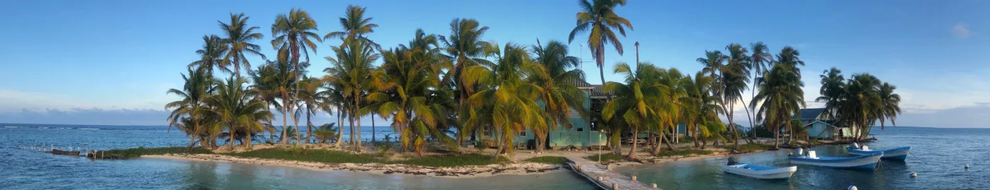
A History of the Carrie Bow Cay Station
On a tiny island off the coast of Belize, scientists embed themselves in the nearly pristine reef and mangrove habitats of the coastal Caribbean. For over 50 years, Carrie Bow Cay and the surrounding cay system has served as a living laboratory, supporting the work of hundreds of scientists from around the world. Though only an acre in size, the island and its research laboratory have had a monumental impact on coastal marine research. Steps from the ocean, the Smithsonian’s Carrie Bow Cay Field Station enables researchers to immerse themselves in the environment in a unique and special way which has often led to new discoveries unfathomable without such access to coral reefs and mangrove forests.
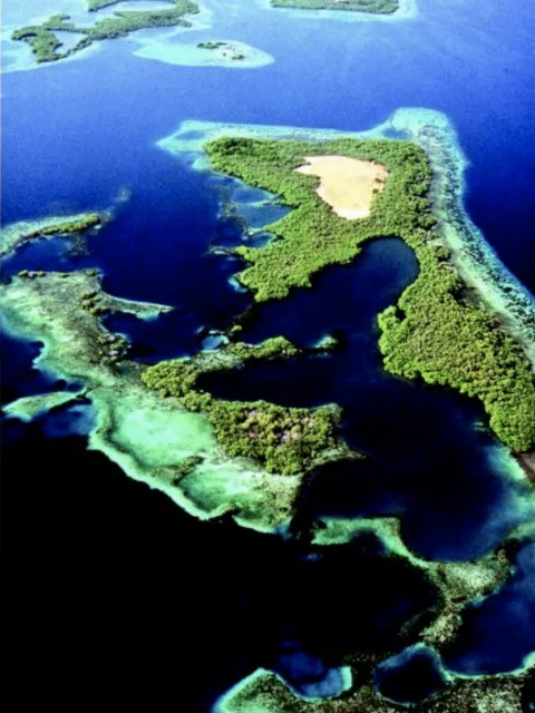
Carrie Bow Cay is one of many island cays that form the Outer Barrier Platform, a shallow area of barrier reefs and mangrove islands off the coast of Belize. This barrier reef is the largest continuous reef system in the Western Hemisphere, extending more than 150 miles (250 km) between Ambergris Cay in the north and the Sapodilla Cays in the south. Towards the shore from the barrier reef is the Shelf Lagoon, a 15 miles (25 km) wide area less than 10 miles (15 m) deep that is rich in biodiversity with coral reefs, seagrass beds, and mangrove forests.
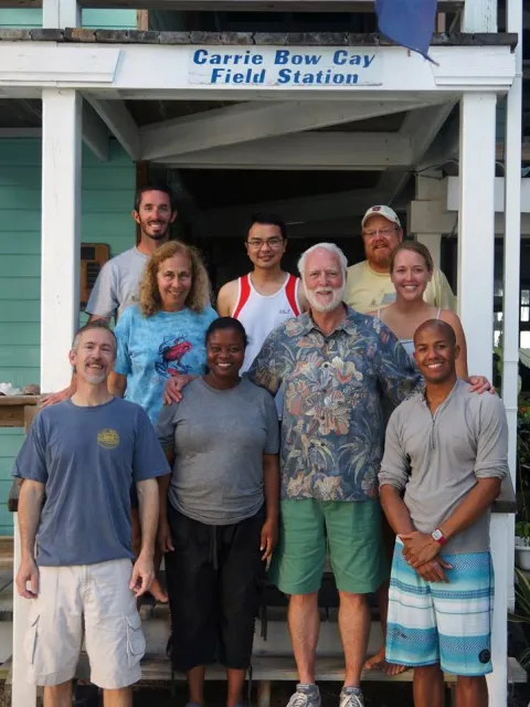
During the 1970s, Smithsonian scientists fostered a relationship with the island’s owners, the Bowman family, and together they built a premier research laboratory right in the middle of Belize’s barrier reef. As the years continued the once primitive facility grew to support hundreds of scientists annually with new laboratories and equipment to support their research. A station manager, once a coveted volunteer position, lives on the island and supervises visiting researchers, local support staff, and a station chef.
Purchase of Bird Caye
The British Honduras government (now Belize) awards land to veterans who fought in Mesopotamia in the Middle East during World War I. Most veterans opt for land in the Mesopotamia area of Belize City, a neighborhood with street names of Middle Eastern origin. One veteran from Stann Creek requests a small, uninhabited cay known for its birds and sea turtle nesting. The cay is known as Ellen’s Caye or Bird Caye. In a time of hardship, the man sells the island to William Alexander Jex Bowman, a citrus pioneer from Stann Creek.

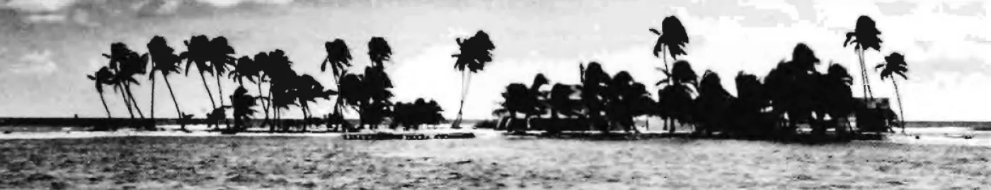
Aerial view of Carrie Bow Cay looking northwest. South Water Cay (right) is a reef island on the barrier trend; Twin Cays (left) is a mangrove island in the shallow lagoon.
Naming Carrie Bow
Henry Thomas Anthony Bowman, a prominent citrus farmer, buys the island from his father. He renames the island after his wife, Carrie and ferries out a house in sections. Upon purchase, the island is two acres in size. Bowman also builds a 90-foot-long concrete boat dock, which is famed for its beautiful tile work. Many island visitors later reminisce of its beauty.

The original tiled dock leads to the island.
Mapping of the Cays
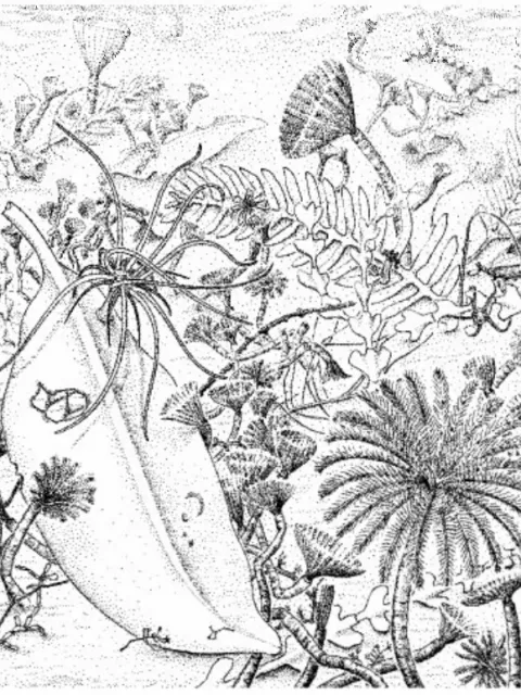
The first investigations focusing on the cays and reefs of Belize are undertaken by the "Cambridge Expedition to British Honduras" led by J. E. Thorpe. Part of the investigation includes mapping 40 cays, including Carrie Bow Cay, and collecting samples of their flora.

The original sketch of the island from the British Survey. (Cambridge Expedition to British Honduras)
IMSWE Program is Established
The Smithsonian Institution establishes the Investigations of Marine Shallow-water Ecosystems program (IMSWE, a precursor to Caribbean Coral Reef Ecosystems Program) with the mission to document coral reef diversity, community structure, and other environmental processes. The Caribbean is deemed the best system to study, given its proximity to the Natural History Museum in Washington, DC. With limited funds they buy an inflatable boat with a horse-powered outboard motor and begin the search for a permanent field station in the Caribbean.

The team included (left to right) Walter Adey, Arthur Dahl, Tom Waller, Klaus Rützler, and Arnfried Antonius.
Glover's Reef Workshop
A Smithsonian sponsored coral reef workshop at Glover's Reef, Belize gathers coral reef scientists to discuss the future of the program. Program founders Arnfried Antonius and Klaus Rützler return to collect and store their equipment and stumble upon Carrie Bow Cay while taking a shortcut from the reef to Dangriga. They learn it is owned by Henry T.A. Bowman, also the owner of Pelican Beach Motel in nearby Dangriga.

An artist's portrayal of the station.
The Bowmans lease Carrie Bow to the Smithsonian
Rützler meets with Henry Bowman Jr. and Alice Bowman and together they agree to lease the southern half of the island to the Smithsonian for three to four months per year. The initial facilities for the science team are primitive and intimate. The facilities consist of a small three room building with a tin roof which included a lab, living quarters for two, and a kitchen. A stone throw away is a small shed that houses two, a tent that accommodates six, a dive compressor and a small generator. The shower consists of a spray-head on a pipe screwed into the bottom of a huge wooden vat where collected rainwater runs in from the roof. After a few years, a room in the main house is used to house the station manager. The island is remote and removed from the modern world—communication with the mainland is limited to only a shortwave radio to call Pelican Beach for supplies. A local cook prepares meals for the station inhabitants.

An early sign indicating the island as a restricted area.
Hurricane Fifi
Hurricane Fifi hits the island, killing most of the plant life on the island. About 20 percent of the coconut trees also die (16 total trees). Some coastal erosion reduces the island's size by about one third, but much of the sand is redeposited only months later.

Hurricane Fifi removes many trees from the island.
Reef Report Describes New Species
An initial report on the local reef with a map of the area is internally published by the Smithsonian. Despite being one of the best studied geographic regions many new species are discovered.

Sara Lewis measuring algal abundance in a quadrat frame on the reef flat.

Detailed Aerial Maps
Captain Graham Thomas of the Royal Signals Detachment is detailed to Belize to support the training of British forces in jungle environments. A helicopter pilot, he takes aerial photos of the reef that help create detailed maps of the area. Prior to this information maps were based on surveys conducted in the 1830s with minor updates in the 1940s.

Captain Graham Thomas of the Royal Signals Detachment takes aerial photos of the reef surrounding Carrie Bow Cay.
Core Samples Reveal Island's Geologic Past
The geology team drills the first core sample to study the history of the reef. They find that the Outer Barrier Platform, the shallow reef that protects the inner lagoon, likely formed relatively recently in geologic time, within the last 7,000 years. Much of the rock bed is composed of coral rubble, indicating it was likely swept in and deposited by the unique topography.
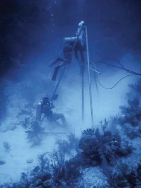
A diver-operated hydraulic drilling rig at one of the drilling sites.
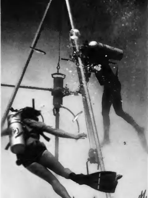
Divers drill at one of the drilling sites.
Hurricane Greta
Hurricane Greta passes over Carrie Bow Cay, damaging equipment, removing the laboratory wall, destroying the small house and outhouses. Severe erosion from the wind and waves removes significant portions of the island and 30 coconut trees. Most of the elkhorn (Acropora palmata) and the fire coral (Millepora complanata) is reduced to rubble and water visibility, usually crystal clear, remains to 10 feet (3 m) for two weeks following the storm. The lagoon, usually a salty 35 percent salinity drops to 25 percent.

Extensive Acropora and Dictyota corals on a sand and rubble bottom (L). Following Greta most of the corals and large quantities of sand were transported toward the lagoon.
SWAMP is Formed
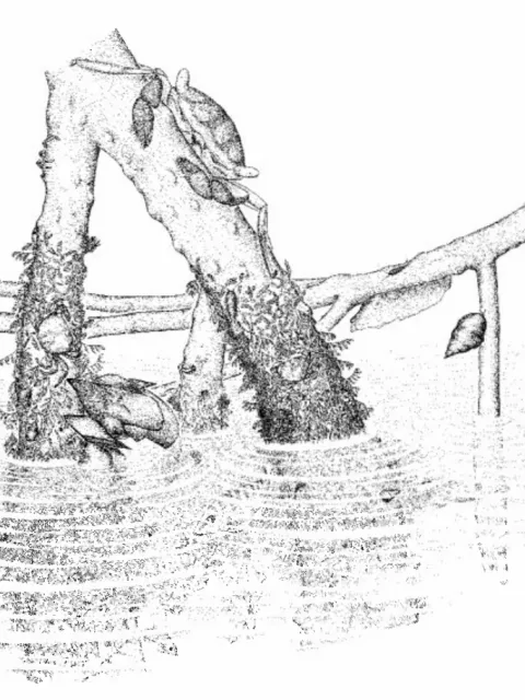
The Smithsonian Western Atlantic Mangrove Program (SWAMP) is launched, with special interest on the dense mangrove forests on nearby Twin Cays. Many scientific illustrators worked on the project to help catalogue life in the mangrove forests and share their often-overlooked beauty.

Two scientists work in the mangrove forest.
Black Band Disease Spotted
Black band disease, first observed by Antonius in Belizean reefs in 1972, makes its first appearance in the reefs off of Carrie Bow. It is the first described coral disease. Corals begin to show signs of black band disease, a coral disease characterized by a blackened band of infected coral tissue that spreads across a coral colony, ultimately killing the coral. Black band disease is ultimately found on 40 coral species throughout the world.

Black band disease discovered just outside the reef crest near Carrie Bow Cay in 2007.

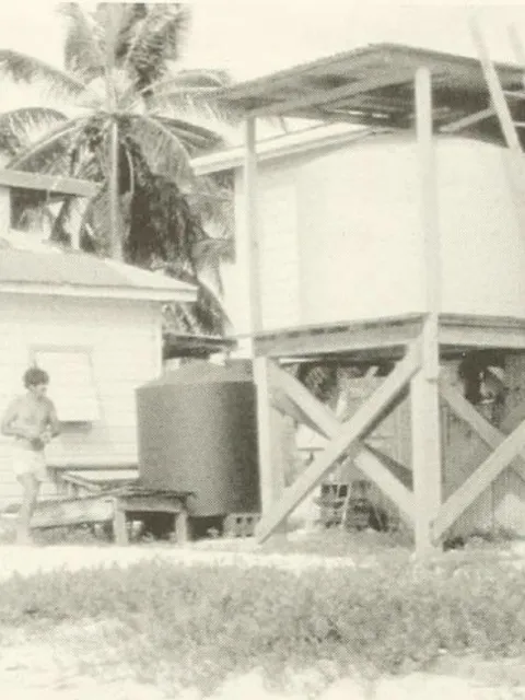
Updates to the Station
As scientists continue to visit the station, it becomes apparent that updated housing and equipment is needed. The big house is remodeled to include dry lab space, a library with a computer, and additional living quarters. A new sound insulated shed protects the compressor-generator, which is used to both power the station and fill scuba dive tanks. The station also adds much-needed propane gas refrigerators to store samples, solar panels and an improved radio system. Other lab equipment and the weather system are updated.

New solar panels power the station.
Operations Manager Mike Carpenter installs a large storage tank for a seawater flow-through system.
Science as Art Exhibition
An exhibition titled “Science as Art” at the Smithsonian’s S. Dillon Ripley International Center in Washington DC showcases the illustrations of mangroves at Twin Cay.
A characteristic intertidal red algal cover (Bostrycbietum) on red-mangrove prop root, with mangrove oyster, mangrove crab, and periwinkle.
A close-up of peat-bottom community with algae, fallen mangrove leaves, sea anemone,and sabellid tube worms.

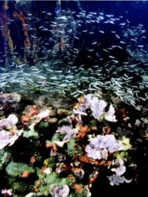
Creation of South Water Cay Protected Area
Researchers at CBC discover that the Pelican Cays, a system of cays southwest of Carrie Bow Cay, are especially diverse with many species from both mangrove and reef habitats living together. Discussions with Belizean officials initiates the creation of the South Water Cay Protected Area, a marine protected area covering 117,875 acres.
An aerial photograph of Cat Cay showing mangrove, reef ridges, and deep lagoons (Manatee Cay, left, and Fisherman's Cay are in the background)
Coral Ridge (Agaricia, Palythoa) with sponges (Chondrilla) at Cat Cay lagoon entrance (sponge-covered mangrove roots in background).
A close-up of ascidian (Clavellina)-sponge (Monancbora, Spirastrella) community, enveloped by brittle star arms, on Manatee Cay mangrove root.
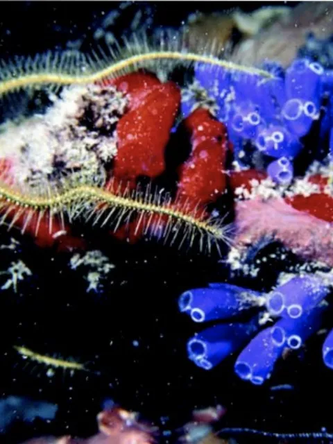
"Eusocial" Shrimp Discovered
Visiting scientist Emmett Duffy discovers a species of snapping shrimp that forms a social structure similar to bees. The shrimp live within sponges and form a colony of up to 300 individuals with only one reproductive queen. It is the only known instance of the “eusocial” colony structure outside of insects.

Two snapping Synalpheus shrimp face on a sponge. (Emmett Duffy)

Fire Destroys Station
On December 6, a devastating fire destroys the station. Old wiring likely creates a spark that easily ignites the station’s termite riddled wood. Fueled by windy weather, the entire station burns to the ground. Valuable research equipment and the library are lost.

The volunteer station manager at the station took this photo as he fled the island. (Smithsonian Institution)
Hurricane Mitch Hits the Island
Hurricane Mitch, a category 5 storm, hits the island. The staghorn coral are reduced to rubble.

In 1978 staghorn corals covered the seafloor. Shortly after, disease decimated the staghorn corals and more than 98 percent of the corals were lost. Storms and hurricanes further harmed the corals. (Smithsonian Institution)
Rebuilding of the Station Commences
Rebuilding of the station commences. Cuban trained architect Hedel Gongora, a friend of the Bowman family, designs and builds a new laboratory.

One of the great losses of the fire was the library. A visitor logbook with entries dating back to the first years of the station is lost. Here is a picture of a more recent entry.


New Director
Founding Director Klaus Rützler steps down as Director of the CCRE program. Valerie Paul, the Director and Head Scientist at the Smithsonian Marine Station at Fort Pierce, Florida steps in to fill the position.
Paul (at left in blue) at the Carrie Bow Cay field station in Belize in 2014 when Smithsonian Secretary Clough (at center right in floral shirt) visits. (Courtesy of Valerie Paul)
Paul collecting specimens in the Florida Keys. Paul has done significant research into the various kinds of bacteria that live on corals, and has identified different ways bacteria and probiotics can both help and harm corals. (Photo by Lindsay Spiers)

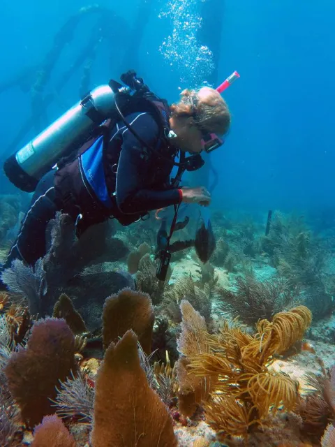
MarineGEO Uses CBC for Study
The Smithsonian’s new Tennenbaum Marine Observatories Network (aka MarineGEO), a marine biodiversity program aiming to monitor marine life across the globe, establishes Carrie Bow as one of its key sites. A team of scientists converge on the island every year to monitor marine biodiversity. The year also marks a visit from Smithsonian Secretary G. Wayne Clough.
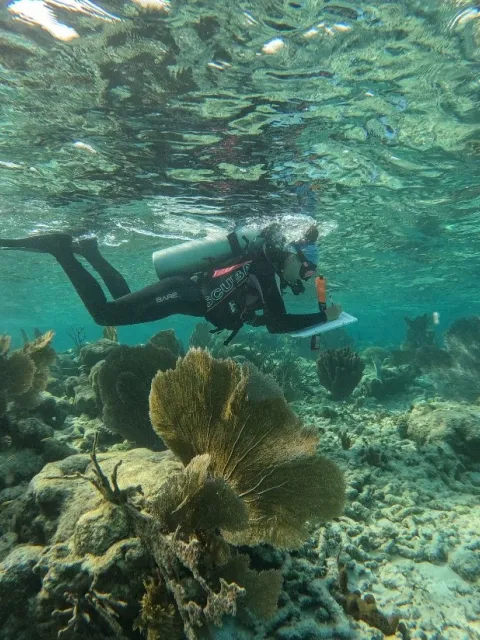
A diver works among the corals during one of MarineGEO's visits to Carrie Bow.
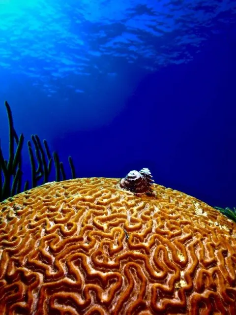
Christmas tree worms grow on a brain coral near Carrie Bow.
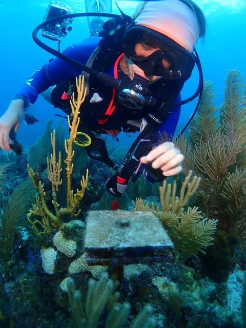
A diver checks a special plate on the reef. These plates, called arms, help scientists measure growth on the reef.
The Island Slowly Errodes
After many years of coastal erosion, the island is less than an acre in size, less than half the size of the island when Henry Bowman, Sr. bought it. Therese, Henry Bowman, Jr.’s daughter, adds sandbag projections to help slow erosion.

An aerial photo of the station taken in 2019.
A Toilet Upgrade
After decades of use, the old outhouse on the end of the pier is decommissioned to decrease the research station’s environmental footprint. New Composting toilets are installed, and though more environmentally friendly, they lack the view and charm of the weathered outhouse.

The outhouse at the end of the dock. (Smithsonian Institution)

SCTLD Appears on the Reef
Upon returning to the station, MarineGEO surveys the reefs and find Stony Coral Tissue Loss Disease (SCTLD). First reported off of Florida in 2014 the disease quickly spread throughout the Caribbean infecting over 20 species of coral.

Tagged Pseudodiploria strigosa (brain coral) colony before (left) and after (right) infection with stony coral tissue loss disease.