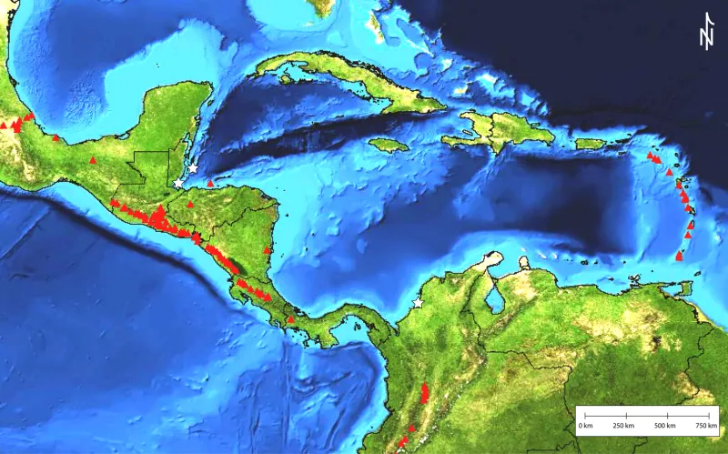
Central American and Caribbean Sea Volcanoes

This map shows volcanoes of Central America and within the Caribbean Sea. The red triangles represent volcanoes known to have erupted in recent time (within the last 10,000 years) and white stars are pumice discovery sites. Learn about how Smithsonian scientists tracked pumice from land back to the volcanoes they came from.

