A Guide to Earthquake Lesson Plans

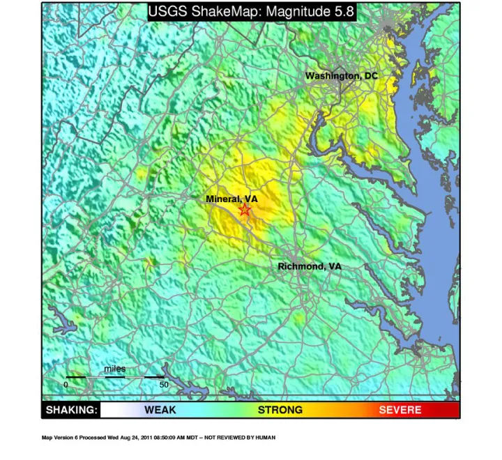
It isn’t everyday that a magnitude 5.8 earthquake strikes the East Coast of the United States. But on August 23, 2011, people from Georgia to New England felt the rumble and shaking of an earthquake whose epicenter was in Mineral, Va. The East Coast is historically a low risk zone. What exactly happened and how might educators use this event in the classroom?
First, take a look at an interview in Smithsonian Magazine with Dr. Elizabeth Cottrell, a geologist with the Smithsonian National Museum of Natural History who puts the Virginia earthquake into context, explaining why it was felt over such a large area, the geology behind this earthquake, and what is generally known about faults in Virginia.
Next, check out this short list of earthquake educator resources for grade levels K-12, many of which are aligned with National Science Education Standards for physical science:
Earth’s Composition: The Earth is divided into layers by its physical and chemical properties: the crust, upper mantle, mantle, outer core, and inner core as shown in this United States Geological Survey (USGS) illustration. The crust and the upper mantle are collectively known as the lithosphere, which is comprised of tectonic plates. You can teach elementary students about Earth’s layers with this fun and edible "Pit of the Earth" activity.
Plate Tectonics: The lithosphere is in constant motion, according to the science of plate tectonics. Scientists are able to better predict earthquakes by using seismic data. In this activity, help your students better understand this science by locating a global earthquake using recent seismic data.
Seismic Waves: Earthquakes generate four main types of seismic waves: Compressional (P) and Shear (S) waves are body waves and Love and Rayleigh waves are surface waves. Watch as Smithsonian Education Specialist Catherine Sutera demonstrates S and P waves with a toy Slinky ® and learn more about using the Slinky activity in your classroom.
Measuring Earthquakes: Seismographs are the devices used to detect and record the vibration of earthquakes. Show your students how to develop their own seismograph with the "Shake It Up With Seismographs" lesson and activity plan.
Calculating Magnitude: Seismologists measure the amount of energy released by an earthquake by calculating its magnitude. The scale commonly used today is a logarithmic scale that uses several factors to calculate the magnitude. Use this USGS magnitude calculator to help students understand how much more powerful the magnitude 9.0 Japanese earthquake was compared to the East Coast 5.8 earthquake.
Become an Geophysicist--Study Earthquakes! A geophysicist is someone who studies the Earth using gravity, magnetic, electrical, and seismic methods. Learn about the different types of geophysicists and read a Q&A with a geologist/geophysicist.
Earthquakes and Tsunamis: Using maps and graphics, Smithsonian geologist Dr. Liz Cottrell provides an overview of the major earthquake and tsunami that struck Japan on March 11, 2011 in this video "Understanding the Japan Earthquake and Tsunami." You can also access "This Dynamic Planet," a Smithsonian/USGS interactive world map of volcanoes, earthquakes, impact craters, and plate tectonics.


