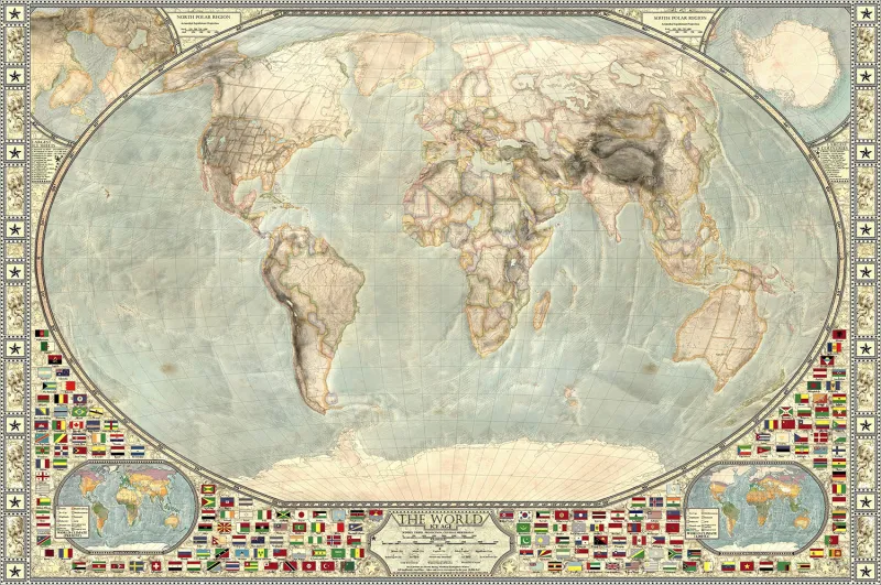
Ice Age Map of the World

This map depicts the Earth during the last ice age, specifically the Late Glacial Maximum (roughly 14,000 BCE) when the climate began to warm substantially. With so much of the planet's water tied up in ice, global sea level was more than 400 feet lower than it is today. The artist worked with climatologists and glaciologists to make the map as accurate as possible.

