

Sea Level Rise
Introduction
The ocean never stops moving. When you visit the beach, waves roll in and recede and the tides rise and fall. These are small daily changes that balance out over time.
But over the past century, the average height of the sea has risen more consistently—less than a centimeter every year, but those small additions add up. Today, sea level is 5 to 8 inches (13-20 centimeters) higher on average than it was in 1900. That's a pretty big change: for the previous 2,000 years, sea level hadn't changed much at all. The rate of sea level rise has also increased over time. Between 1900 and 1990 studies show that sea level rose between 1.2 millimeters and 1.7 millimeters per year on average. By 2000, that rate had increased to about 3.2 millimeters per year and the rate in 2016 is estimated at 3.4 millimeters per year. Sea level is expected to rise even more quickly by the end of the century.
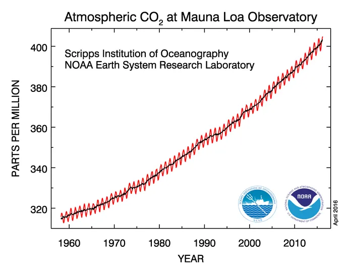
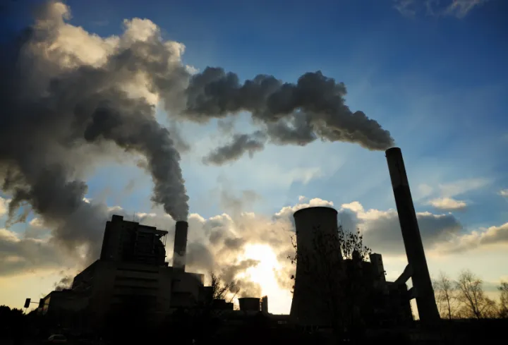
Scientists agree that the changes in climate that we are seeing today are largely caused by human activity, and it's climate change that drives sea level rise. Sea level started rising in the late 1800s, soon after we started burning coal, gas and other fossil fuels for energy. When burned, these high-energy fuel sources send carbon dioxide up into the atmosphere. Carbon dioxide absorbs heat from the sun and traps it, warming the atmosphere and the planet.
As the planet gets warmer, sea level rises for two reasons. First, warmer temperatures cause ice on land like glaciers and ice sheets to melt, and the meltwater flows into the ocean to increase sea level. Second, warm water expands and takes up more space than colder water, increasing the volume of water in the sea.
Sea level rise will hit the coasts the hardest. Over the coming centuries, land that is today home to between 470 and 760 million coastal residents will be inundated by sea level rise associated with a 4 degree Celsius warming that will occur if we fail to curb the amount of carbon dioxide in the atmosphere. Much of this population lives in cities. Sea level rise already makes storms more dangerous, causing more flooding and damage in areas crowded with people. And it will affect different parts of the world differently, with some parts of the planet being particularly hard hit.
History of Sea Level Rise
Almost all of the water on Earth is stored in two places: in the oceans (currently 97 percent of all water) and in glaciers (currently about 2.7 percent). How much water is in the oceans—and thus how high sea level is—largely depends on how much water is trapped in glacial ice.
Throughout our planet's history, sea level has risen and fallen dramatically. At times, there was no ice at the poles and the ocean was hundreds of feet higher than it is now; at other times, ice covered the planet and sea level was hundreds of feet lower. These changes are part of Earth's natural glacial cycles and have occurred over millions of years. Scientists use sediment and ice cores to learn more about sea level before the advent of tide gauges and satellites.
Last Glacial Period
Earth's most recent glacial period peaked about 26,500 years ago. At that time, around 10 million square miles (26 million square kilometers) of ice covered the Earth. The Laurentide ice sheet covered Canada and the American Midwest, stretching over Minnesota and Wisconsin south to New York and the Rocky Mountains. Across the Atlantic, ice blanketed Iceland and stretched down over the British Isles and northern Europe, including Germany and Poland. The Patagonian ice sheet crept north from Antarctica to cover parts of Chile and Argentina. The climate was colder and drier globally; rain was scarce, but pockets of rainforest survived in the tropics. With so much of the planet's water tied up in ice, global sea level was more than 400 feet lower than it is today.
Low sea level meant that some land masses that are currently submerged were accessible to people. One of the best known is the Bering Land Bridge, which connected Alaska to Siberia. The first people to reach the Americas migrated across the land bridge and settled here. Land animals also made the journey over the bridge in both directions to colonize new continents. As the world's glaciers and ice sheets melted during the following millennia, the Bering Land Bridge was flooded and disappeared beneath the ocean's surface, cutting off the migration route.
Sea Level on the Rise
Over the past 20,000 years or so, sea level has climbed some 400 feet (120 meters). As the climate warmed as part of a natural cycle, ice melted and glaciers retreated until ice sheets remained only at the poles and at the peaks of mountains. Early on, the sea rose rapidly, sometimes at rates greater than 10 feet (3 meters) per century, and then continued to grow in spurts of rapid sea level rise until about 7,000 years ago. Then, the climate stabilized and sea level rise slowed, holding largely steady for most of the last 2,000 years, based on records from corals and sediment cores. Now, however, sea level is on the rise again, rising faster now than it has in the past 6,000 years. The oldest tide gauges and coastal sediment preserved beneath swamps and marshes show that sea level began to rise around 1850, which is right around the time people started burning coal to propel steam engine trains, and it hasn't stopped since. The climate likely started warming as a part of a natural cycle, but the accelerated warming in the last two hundred years or so is due to a rise in atmospheric carbon dioxide. The resulting rise in sea level is likely twice what we would have seen without the increase in greenhouse gasses due to human activities.
Today, global sea level is 5-8 inches (13-20 cm) higher on average than it was in 1900. Between 1900 and 2000, global sea level rose between 0.05 inches (1.2 millimeters) and 0.07 inches (1.7 millimeters) per year on average. In the 1990s, that rate jumped to around 3.2 millimeters per year. In 2016 the rate was estimated to be 3.4 millimeters per year, and it is expected to jump higher by the end of the century. Scientists with the Intergovernmental Project on Climate Change predict that global sea level will rise between 0.3 and 1 meter by 2100. Eventually, sea level is expected to rise around 2.3 meters for every degree (°C) that climate change warms the planet, and Earth has warmed by 1°C already. What scientists don't know is how long it will take for sea level to catch up to the temperature increase. Whether it takes another 200 or 2000 years largely depends on how quickly the ice sheets melt. Even if global warming were to stop today, sea level would continue to rise.
Why is it Rising?
Global warming associated with human activities causes sea level to rise in several ways.
Thermal Expansion
The idea that water expands when heated seems strange, but it is a property of most objects that occurs at the molecular level. When water molecules are heated, they absorb energy. That energy causes the molecules and atoms to move around more and, in the process, take up more space. If you heat up a cup of water, the small molecular expansions don't add up to a difference we can detect by eye. But when you have vast numbers of water molecules, like in the ocean, the tiny expansions add up to something we can see.
Thermal expansion is an ongoing contributor to sea level rise as long as ocean water continues to increase in temperature.
Melting Ice
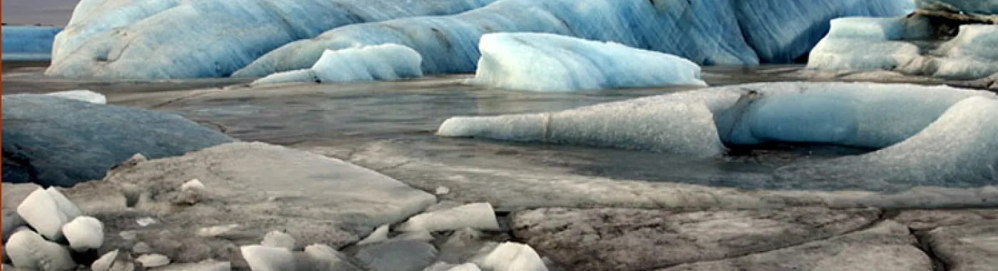
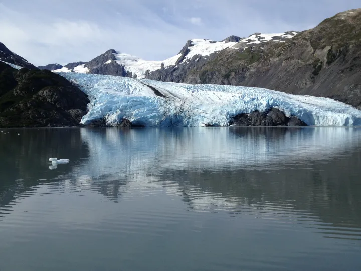
Glaciers and ice sheets, large land-based formations of ice, are melting as global temperatures rise. That meltwater drains into the sea, increasing the ocean's water volume and global sea level. Melting ice has caused about two-thirds of the rise in sea level to date, one-third from land ice in Greenland and Antarctica and one third from melting ice on mountains.
Ice sheets and glaciers in Greenland and Antarctica melt three ways: from above due to warming air, from the sides as they break off into the sea, and from below due to warming ocean water where the ice extends over the sea. Because of this, the rate of ice melt varies from place to place as conditions change. The Arctic is warming more quickly than the Antarctic, which explains why the ice there is thinning more quickly. However, recent research suggests that the melting of Antarctica’s ice shelves may be unstoppable—although the process may take centuries.
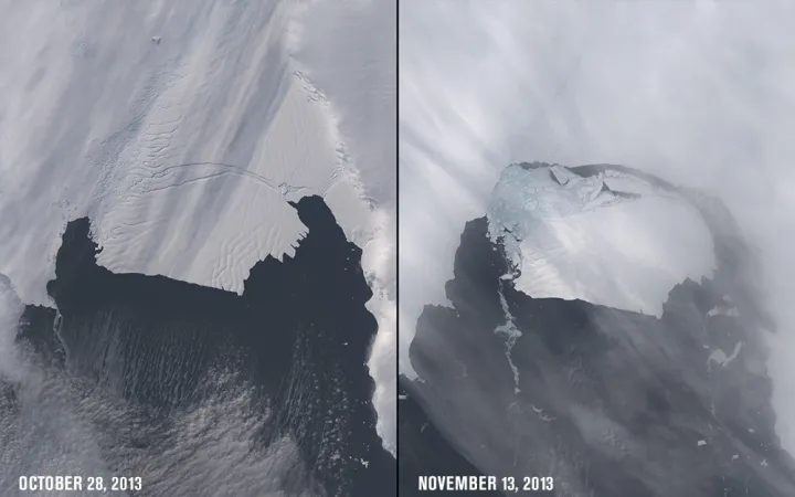
It wasn't until 2008 that scientists grasped the extent to which warm water melting glaciers from below accelerates ice melt. Many glaciers and ice sheets extend into the ocean at their coastal edge, and the floating ice is called an ice shelf. Ice shelves support ice sheets and glaciers by holding the ice on land. But as ocean temperatures increase, warm water laps at the ice shelves, weakening them and causing them to calve glaciers into the sea. This both accelerates ice melting and destabilizes land-based glaciers and ice sheets. This destabilization and acceleration has already been observed at some Greenland glaciers like Jakobshavn Isbrae, which is speeding into the sea faster than any other glacier on Earth. Pine Island Glacier, another fast-paced glacier in the Antarctic, is also changing quickly. The 5-year NASA mission Oceans Melting Greenland (OMG), launched in April 2015, seeks to better understand how ocean water melts ice from below. Like this one, new discoveries about sea level change are made all the time.
In the future, the melting of ice sheets will dominate sea level rise. Warming has already caused major changes in the ice sheets, continental masses of ice which hold a greater volume of ice than glaciers and ice caps combined. These changes are irreversible in the short term, says NASA's Eric Rignot, and it would take centuries to reverse the trail of ice retreat. In addition to polar ice, the melting of mountain glaciers, like those in the Andes and Himalayas, has caused an equal amount of sea level rise to date. However, because mountain glaciers include only one percent of all land ice, polar ice will eventually greatly surpass their contributions to global sea-level rise.
Other Contributions
There are other small contributions to sea level rise. Some ice sheets are so massive that they alter the Earth's gravitational pull. As ice caps melt, both the gravitation pull on Earth and the planet's rotational spin will change, affecting local sea level in complicated ways. Sea levels may rise in some places, and drop in others. Greenland's ice sheets currently pull on the surrounding ocean, creating a slight bump in the ocean in that area of the world. When the ice on Greenland melts and that pull is lost the sea level in places like Iceland and Norway will actually drop. But that water will have to go somewhere. The ocean water will redistribute so that across the globe by Japan and Hawaii sea level will rise more than the global average.
Other human impacts can decrease sea level rise, such as building dams and artificial reservoirs to store water. When people use wells to pump water from underground reservoirs, that water eventually reaches the ocean. But none of these are capable of influencing sea level to the same extent as thermal expansion and the melting of large glaciers and ice sheets.
Modern Sea Level
Measuring Global Sea Level

Global sea level is the height of the ocean's surface averaged throughout the world, and is what is often discussed in the news. Historically, it has been challenging to measure because the ocean's surface isn't flat; it changes daily or hourly based on winds, tides, and currents. Up until 1993, tide gauges measured global sea level. Tide gauges are usually placed on piers, and they continuously record the height of the water level compared to a stable reference point on land. There are around 2,000 tide gauges around the world run by around 200 countries. Some have been recording sea level data since the 1800s—and a few for even longer.
But thanks to satellites, scientists have gotten a better handle on global sea level and how it has changed over time. Satellites take much more comprehensive measurements. In 1992, NASA launched TOPEX/Poseidon, the first of a series of satellites that measure sea level rise from space. It was followed by Jason-1 and OSTM/Jason-2, and most recently Jason-3 which was launched successfully on Jan 17, 2016. These satellites use precise radars to bounce signals off the ocean's surface to determine the height of the ocean. "The instruments are so sensitive that if they were mounted on a commercial jetliner flying at 40,000 feet, they could detect the bump caused by a dime lying flat on the ground," says Michael Freilich, Director of NASA's Earth Science program. With this information, NASA scientists calculate the average change in height almost everywhere across the globe once every 10 days.
In 2002, NASA launched the GRACE satellites, which track both ocean and ice mass by measuring changes in the Earth's gravitational field. The paired satellites orbit the Earth together and are spaced roughly 200 kilometers apart. Ice and water moving around the Earth exert different gravitational forces on the GRACE satellites. The satellites can sense the miniscule changes in the distance between one another caused by the change in gravitation force, which they measure and use to track water and ice mass change. It's thanks to GRACE that we know where the water flowing into the ocean came from. According to GRACE, melting of ice in Greenland increased sea level by 0.74 mm/year and melting in Antarctica by 0.25 mm/year since 2002.
Changing Regional and Local Sea Levels
Although sea level is rising globally, in some places it is rising more quickly than others, and in some places, sea level is even falling. This type of local- and regional-scale sea level change is what is most important when talking about the impacts of sea level on people and communities and how to plan for and manage those impacts.
Different places will experience varying consequences of sea level change for many reasons:
- Some coastal areas are positioned high above sea level—such as Scotland, Iceland, and some parts of Alaska—while others are much closer to, or even below, sea level, such as New Orleans, Louisiana and much of the eastern United States. Coasts are constantly moving and changing, with inputs from tectonic plates.
- Local geology can make land more resistant or prone to becoming saturated with encroaching seawater and eroding away.
- When ice sheets melted at the end of the last ice age, a great weight was removed from some areas. To understand what has been happening since it helps to think of a person (like an ice sheet) sitting on an air mattress (the land). When the person stands up (the ice melts), the part of the mattress underneath and close to the person springs back up; but the parts of the mattress far from the person sink back down. The same rising and sinking are still happening all over the world, even thousands of years after continental ice sheets have disappeared. This is called glacial isostatic adjustment.
- Prevailing winds and ocean currents can push water towards or away from the coast.
Additional factors such as rainfall, vegetation, ice cover, groundwater extraction, coastal development, and oil and gas drilling can affect how well a region can handle rising sea levels.
See the "Regional Case Studies" section for examples of places already facing the consequences of rapid sea level change to demonstrate how it varies around the world.
Impacts
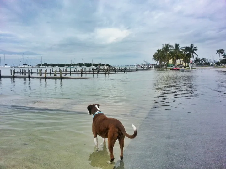
As sea level rises, ocean waves won’t roll onshore and submerge houses and communities all at once like in a summer blockbuster. The first signs of sea level rise will be increased damage from hurricanes and other storms and even high tides. Minor and major flooding will become more frequent. Coastlines will erode and creep backward almost imperceptibly. In fact, all of these impacts are already happening.
Storms and Flooding
As the waterline creeps up along coasts, storms and flooding will happen more frequently and dramatically. Think of the ocean as the launching pad for storms and floods: the closer the sea is to human communities, the easier it is for floods to reach homes, roads and towns. Flooding over roads, which is already becoming more common in some places during high tides, can cause traffic jams and block emergency vehicles from reaching flooded areas.
Imperceptibly to us, flooding is already becoming more common along the eastern United States. A 2014 Reuters analysis found that, before 1971, water reached flood levels no more than five days every year (on average) in several U.S. east coast cities. Since 2001, however, that number has risen to 20 days or more (on average). At this point, each of these floods is a relatively minor event, maybe closing a few roads, some home damage or causing businesses to close for a period of time. But as they become more frequent, these inconveniences will add up and make people's lives harder, not to mention cost money because of damages.
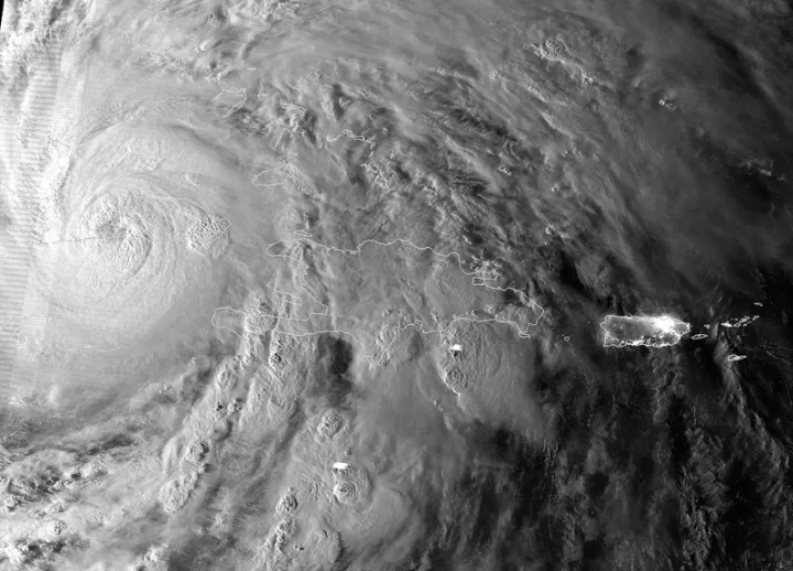
Likewise, flooding during storms—sometimes called storm surges—will reach farther inland as sea level rises. During hurricanes and other large storms (like Nor’easters), strong winds push water beyond the normal high tide mark; beach houses are often built on stilts to protect against these storm surges. They are likely to get worse as sea level rises due to increased flooding danger across the board. Additionally, as the ocean warms from climate change, it will provide more energy to hurricanes, potentially making them stronger. Over the next century, hurricanes are estimated to grow between 2 and 11 percent stronger on average, according to NOAA. Combined, these are the "one-two punch of rising seas," say researchers at Columbia University, increasing the reach and power of storm surges.
Storm surges already present the biggest danger to human communities whenever a hurricane hits. During Hurricane Katrina in 2005, storm surges of 10 to 28 feet destroyed buildings in Louisiana and Mississippi, flooded parts of New Orleans, and killed (directly or indirectly) around 1,200 people. In 2012, 9-foot storm surges caused by Hurricane Sandy flooded parts of New York City's subway system and destroyed homes along the New Jersey coast. As sea level rises, dangerous storm surges will become more frequent and powerful.
The strength of any given storm can't currently be directly linked to climate change. But as sea level rises, bigger floods will become more frequent.
Changing Coastlines
Sea level rise will reshape coastlines as incoming water floods dry areas and erodes coastal features like beaches, cliffs and dunes. This already occurs during big storms like Hurricanes Katrina and Isaac, and encroaching sea level will cause more drastic changes. As waves reach further inland, they can inundate wetlands and kill the marsh grass that holds the sediment in place. Without grass as an anchor, sediment and mud can be pulled to sea or pushed further inland. Saltwater marshes are actually quite resilient and capable of moving up and inland when threatened by sea level rise if they are given the space. But many coasts have physical barriers that would impede this adaptation.
The effects on sandy beaches will depend on how they are developed. Sandy beaches constantly change as waves, currents and tides carry sand and sediment to and from the shore. When sea level rises on an undeveloped beach, natural processes push the beachfront towards the land. However, there are many homes and businesses behind the beach that will prevent the beach from moving inland. According to California Sea Grant, nearly 60 percent of California’s sandy shoreline is not able to migrate landward because it is bordered by man-made structures. Additionally, seawalls and other offshore structures may interfere with the natural systems that manage beach erosion. Barrier islands—small islands made of sand that run parallel to the coast and act as barriers for the coast during storms and surges—will also be impacted by sea level rise.
Saltwater Intrusion
Sea level rise is not just a problem of water, it is also a problem of salt. Imagine if salt water flooded a farmer's field, or a coastal forest. Not only does the area have to survive flooding, but also a drenching in salt water that can kill plants and irreversibly alter soil chemistry. Saltwater flooding can mean death for these ecosystems. Already scientists have seen stands of "ghost forests" where once-healthy trees were killed by saltwater flooding, and farmers' fields are being converted to tidal marsh and salt flats.
This isn't just an effect of flooding. Salty ocean water can also flow underground into groundwater reservoirs, which are used for drinking water. It can also flow into the water table below the surface of the land, making the soil too salty for trees and plants to grow. This is called saltwater intrusion. Saltwater intrusion can also affect estuaries and freshwater areas that fisheries and coastal communities rely upon.
The challenge will be human adaptation to these kinds of changes. This is particularly difficult when the saltwater intrusion affects drinking water supplies. Saltwater intrusion has long been an issue in managing coastal aquifers that hold freshwater. If the land surrounding an aquifer pokes out abutting the ocean, the freshwater will typically stop the saltwater from intruding due to its relatively higher elevation. But saltwater can slowly seep in over time and contaminate freshwater when that elevation (and pressure from above) changes. This pressure change happens when freshwater is extracted from the ground. Climate change will increase the occurrence of droughts, and instances of saltwater intrusion will occur more often as storm surges and floods deposit saltwater onto land, and more freshwater is removed from aquifers.
There's No Place Like Home
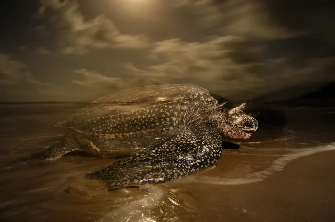
Not only humans, but other animals that rely on low-lying habitats will be impacted by sea level rise. Many birds use coasts and coastal ecosystems for breeding, laying eggs, finding food, or simply as a place to live. Sea turtles lay their eggs on beaches, returning to the same location every year. When beaches erode, or are covered by rising seas their options become more and more limited. Physical barriers that humans are considering to stop the rising seas, like sea walls, completely impede the turtles from coming ashore to build nests and lay eggs.
Species that are only found on islands are especially vulnerable, as their range is limited and they tend to already be vulnerable to extinction. With sea level rise animals like seabirds may not be able to react quickly enough to changes and their only homes may be inundated.
Saltwater intrusion will mean that coastal plant and tree species that can’t handle salt water may die off, and a change in species biodiversity may occur. Along New York's Long Island Sound, for example, tidal marsh plants have moved into previously forested areas flooded by rising sea level. This is natural ecological adaptation, wherein organisms that are better suited to regular saltwater flooding can now thrive in the area. Over time, a diverse and healthy marsh ecosystem may develop in its place.
Regional Case Studies
Below are some examples of places already facing the consequences of rapid sea level change to demonstrate how it varies around the world.
Florida and the U.S. Gulf Coast
A few times a year, when the pull of the sun and the moon align to join forces, coasts are hit with extra-high tides called King Tides. While King Tides are normal, their recent impacts are not. Thanks to sea level rise, King Tides reach higher and further inland now than they did 20 years ago, causing flooding in Miami and along Florida's coast. To some, it's a preview of how sea level rise will cause more frequent and higher flooding on coastlines around the world. It's also a staging ground for how to protect against rising seas; already, new pumps are restraining the ever-higher King Tides—for now.
Not only King Tides, but everyday tides are also already causing nuisance flooding. Climate Central calculated that “roughly three-quarters of the tidal flood days now occurring in towns along the East Coast would not be happening in the absence of the rise in the sea level caused by human emissions.” (See “Storms and Flooding” below.)
Florida is the U.S. state facing the gravest consequences from sea level rise. According to NASA, three feet of water will ultimately inundate land along Florida's coast based only on the warming humans have caused so far.
Sea level is threatening Florida more profoundly than elsewhere for two main reasons. First, its elevation is very low; like many areas along the U.S. Gulf Coast, much of the land sits within a few feet of high tide, ensuring that a small change in sea level is noticeable. The second is that Florida sits on a bed of limestone, which is a very porous kind of rock. Saltwater readily infiltrates and erodes the limestone, driving flooding. Seawater is also likely to push its way into freshwater systems and drinking water reservoirs in these areas.
Island Nations
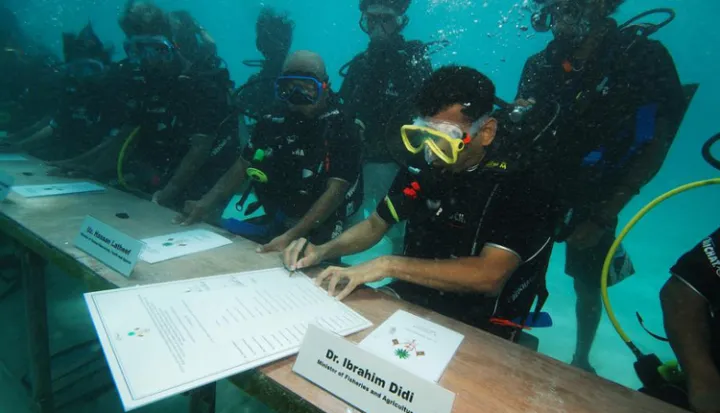
Small island nations, including the Maldives, Kiribati and Tuvalu, are already grappling with the effects of sea level rise. The "52 [small island] nations, home to over 62 million people, emit less than one per cent of global greenhouse gases, yet they suffer disproportionately from the climate change that global emissions cause," says Achim Steiner, executive director of the United Nations Environment Programme.
The people of each island nation face their own unique challenges, but some common themes emerge. As sea level rises, they face increased flooding and erosion of their shorelines, and sources of fresh water and agricultural land become unusable when seawater seeps in.
The Maldives is the lowest country on the planet. The average height of its 1,200 islands, which spread across 1,000 miles (1,600 kilometers) in the Indian Ocean, is only four feet (1.2 meters) above sea level. Already, ever-higher waves encroaching on the shores of the lowest islands erode beaches and there is nowhere for residents to retreat to when a tropical cyclone or a tsunami wave approaches. Residents have even been forced to move as the world's first climate change refugees.
Some strategies may buy some time—at least for some islands. Islands can rise as coral reefs grow upward and sand is added to beaches. Dikes and seawalls can hold the ocean back. But ultimately, many people will abandon their lifestyles and livelihoods on threatened islands as encroaching waves force them to move elsewhere.
Alaska
Alaska is a perfect demonstration of variation in regional sea level change: in some places, sea level is rising, and in others it is falling. Along the southern coast of Alaska, the land is rising two-to-four-times faster than the sea thanks to the region's geology (featuring a collision of tectonic plates and glacial rebound, both causing the land to rise). But along the Bering Sea and the Arctic Ocean, other impacts from climate change are already affecting Alaskan communities in the form of increased storm surges, thawing permafrost, saltwater intrusion and coastal erosion. Furthermore, sea ice is now less protective of the coast because so much of it has melted. The result is that storms are stronger, flooding is more frequent, and coastlines are eroding along parts of Alaska's coast.
After enduring flooding and erosion, so far six Alaskan communities have voted to resettle elsewhere and 160 others are threatened, according to the Army Corps of Engineers. However, these towns don't yet have a place to land. These are just the first of millions of climate change refugees expected to see their homes go underwater in the next century.
River Deltas
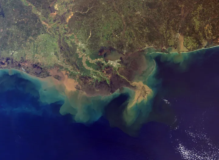
Areas where big rivers flow into the sea are particularly susceptible to sea level rise. These are low-lying areas to begin with, and their landforms are constantly in flux from water flow and sediment carried from land. Additionally, because of their historical importance as ports and locations near cities, governments have built a great deal of infrastructure around these deltas to keep them stable. Ironically, this could be their downfall. In attempting to preserve the current state of deltas, seawalls and other structures may prevent natural processes that would help them adapt to rising sea level.
Additionally, millions of people rely on the fertile farmland near river deltas for food and livelihood. Flooding as sea level rises could displace millions of people and lead to food shortages. For example, it's estimated that sea level rise of less than two feet (0.6 meters) will affect 3.8 million people that rely on food from the Nile River delta, and sea level rise of five feet (1.5 meters) will flood out around 17 million people in Bangladesh.
Future Sea Level & Adaptation
Predicting future sea level rise is a difficult task because scientists don't know how quickly the planet will respond to the warming climate.
The Intergovernmental Panel on Climate Change is the international United Nations group tasked with summarizing climate change research every few years. Their 2013 report projected that sea level will rise by 2 to 3 feet by 2100 if we do not slow our carbon dioxide emissions by using less energy or using renewable energy. That is enough to threaten coastal cities and flood island nations. Even if we reduce our emissions, the report predicts that by 2100 sea level will rise by 1-2 feet, which is enough to cause much coastal flooding and erosion. Some scientists consider these estimates to be conservative, and expect greater sea level rise. The U.S. National Climate Assessment, for example, estimates that sea level will rise between 2 and 6 feet by 2100.
Sea level rise is a reality we will have to face. What can we do to minimize the damage and prepare for what comes?
Reducing Emissions
The best way to minimize future sea level rise is to cut our fossil fuel use and reduce carbon emissions. Even though some sea level rise is inevitable, we have time to reduce how much will occur. There is some debate, but according to one study every 1°C of warming will cause sea level to rise by about 2.3 meters. So the sooner we can slow our warming trend, the easier it will be for future generations to adapt.
Holding Back the Sea
Can walls hold the water back? Some seem to think so, at least in the short-term. Coastal barriers have been used for thousands of years, dating as far back as the ancient Roman Empire. Whether to make man-made harbors for shipping needs or simple walls in order to stop erosion, humans have attempted to engineer coastlines for a long time.
The response to sea level rise is no different, and many communities plan to build barriers in order to protect homes and cities from the rising tide. With the predicted increase in storms (both their intensity and frequency) physical walls can act to reduce flooding that is extremely costly—more costly than building the walls themselves one study says. This type of adaptation will likely increase as the costs of not building walls becomes more apparent over time. Building barriers won’t reduce sea level rise or even completely remove the impacts, but could greatly reduce costs and buy coastal residents some more time.
Sea walls aren’t a one-and-done fix, however. They must be maintained consistently, as waves and salt quickly erode concrete, and as sea level rises they will need to be built higher and higher. This type of man-made barrier also has implications for the natural coastline. They can render sandy beaches useless for both humans and the animals that call it home—causing erosion and disrupting the natural movement of sand and waves.
Some countries, like the Netherlands, have been dealing with these types of water issues for centuries. The Dutch have found success at adapting to changing sea levels by using involved water management systems, encouraging the use of floating homes and generally incorporating adaptations into city planning. New plans involve “Room for the River,” which involve adaptations that allow for flooding, rather then simply trying to stop the water with dams and dikes.
Moving Inland
Sea level has changed and coastlines shifted throughout human history, and people adapted by moving somewhere else. Some people use this history of human adaptation as an excuse to avoid thinking about or acting on climate change and sea level rise.
In one sense, they're right: People have always adapted. The difference this time around, however, is that our coastlines are lined with the homes of millions of people, and the cities, power plants and ports they rely upon. This time around, it won't be easy to pick up and move inland without massive effort and reconstruction. Concerns over property values and rising insurance rates (or the unavailability of any insurance) are already ever present as flooding events occur more often and in areas that haven’t had flooding historically.
Over the next century, people will be forced to abandon their homes along the coasts as higher tides and increased flooding make life difficult. Many cities, states and countries are already incorporating sea level rise and shifting coastlines into their planning and policy documents. Not only people, but animals will have to move and adapt. Scientists are already working to help Laysan albatrosses establish colonies on higher ground.
Additional Resources
NASA Climate page
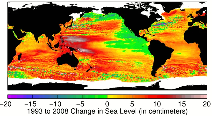
NASA - Visualization of regional patterns of sea level change
Surging Seas - Climate Central
NASA Images of Change
NASA Climate Time Machine
Tide gauge history
Fifth Assessment Report from the Intergovernmental Panel on Climate Change
News Articles:
Rising Waters: How Fast and How Far Will Sea Levels Rise?
Rising Sea Level Will Slow Earth's Rotation
3.2 Millimeters: A Troubling Rise in Sea Level
Pacific Islands Take Steps to Counter Rising Sea Levels
Scientific Papers:
Links between climate and sea levels for the past three million years - Kurt Lambeck, Tezer M. Esat and Emma-Kate Potter
Sea-Level Rise from the Late 19th to the Early 21st Century – John Church and Neil White
Temperature-driven global sea-level variability in the Common Era – Robert Kopp, Andrew Kemp, et al.
Probabilistic reanalysis of twentieth-century sea-level rise – Carling C. Hay, Eric Morrow, Robert E. Kopp and Jerry X. Mitrovica
The multimillennial sea-level commitment of global warming – Anders Levermann, Peter U. Clark, et al.