Plot Your Course
Lesson Plan Overview
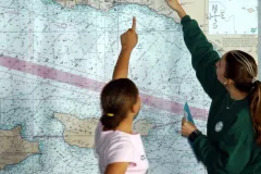
Charting your course on the high seas is a skill required of all seafarers since the beginning of ocean exploration. In this lesson, students will use nautical charts to determine the distance between locations. They will also identify obstacles and features that can aid in navigation.
Lesson Plans
Navigation Lesson Plan LinkLiteracy Principles:
OLP#7: The ocean is largely unexplored.


