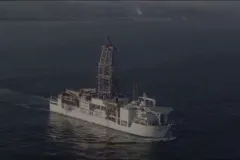
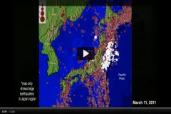
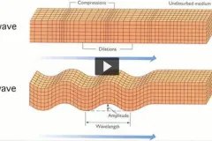
Breadcrumb Home Search Site Search Sort by RelevanceTitle SortAuthored on Order AscDesc Sort By RelevanceA-ZZ-ANewestOldest Video The Ocean Drilling Vessel Chikyu December 2009 Watch the Video Video Understanding the Japan Earthquake and Tsunami March 2011 Watch the Video Video Tracking Tsunamis January 2011 Watch the Video Slideshow Collaborator Research December 2009 See the Full Slideshow Article A Guide to Earthquake Lesson Plans August 2011 Read the Full Article Photo Map of the Magnitude 5.8 Virginia Earthquake of 2011 August 2011 View Image Video Demonstrating an Earthquake's Seismic Waves August 2011 Watch the Video Photo Seafloor Earthquakes Study January 2010 View Image Photo Deep Sea Drilling Vessel Chikyu January 2010 View Image Photo Graph of magnitude 5 or greater earthquakes from 1970- April 2011 April 2011 View Image Photo Graph of magnitude 5 or greater earthquakes from 1900- April 2011 April 2011 View Image